🚀 The Kalisio team is honoured to use all its technical expertise to support Airbus UpNext as part of its Optimate demonstrator, which explores innovative technologies that contribute to the safety and efficiency of air transport face à l’encombrement croissant des aéroports.
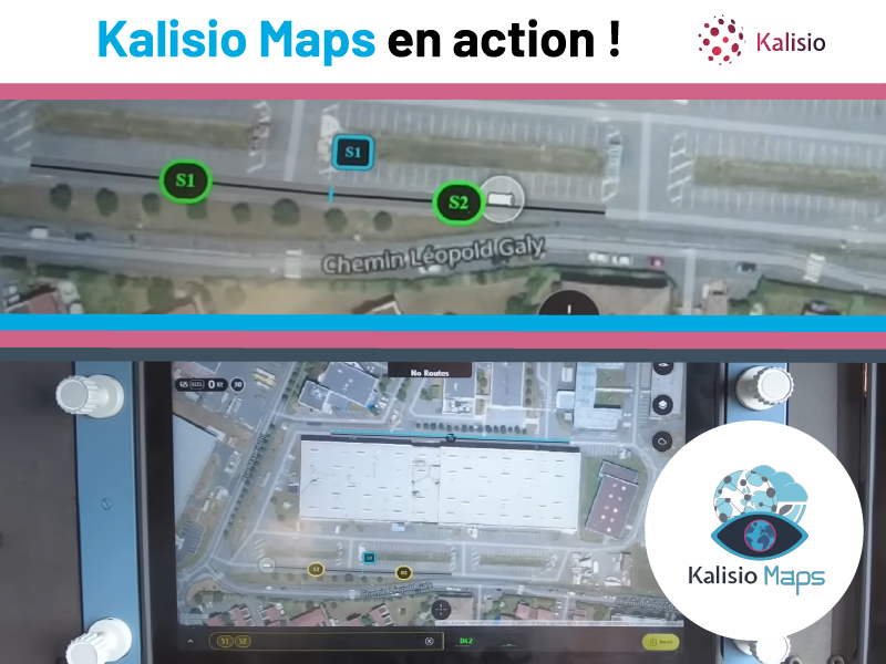
🔎 Our real-time collaborative mapping solution, Kalisio Maps (aka Kano) Assists the Airbus UpNext wheeled aircraft on the runways of theAéroport Toulouse-Blagnac. It is an essential component of the virtual flight assistant, supporting strategic decisions and streamlining interactions between pilots, air traffic control and airline operations centers.
🎯 Our participation enables the demonstrator to benefit from our contributions to a previous demonstrator, and of the platform GIFTwhich provides real-time geographic services to an ecosystem of flight test applications.
🌟 This collaboration reinforces our commitment to the safety and reliability of critical systems. In fact, the final phase of the prototype will consist in using the virtual assistant during a door-to-door mission supported by autonomous systems. on an Airbus A350 test flight. It also demonstrates the ability of an open-source software and cartographic data company to provide innovative and operational solutions for the aeronautical industry.