First of all, our online help is getting a makeover! On the one hand, it is now accessible via a new presentation site. On the other hand, each feature of the application includes an interactive tutorial to guide you step by step when you are lost (to do this, click on the ? icon in the top bar at any time).
Then, many ergonomic improvements are on the program:
– quick and direct photo capture from your events,
– free zoom on the photos of your events,
– interactive magnifying glass on the text content of your events,
– list and modify labels by batch to simplify their management.
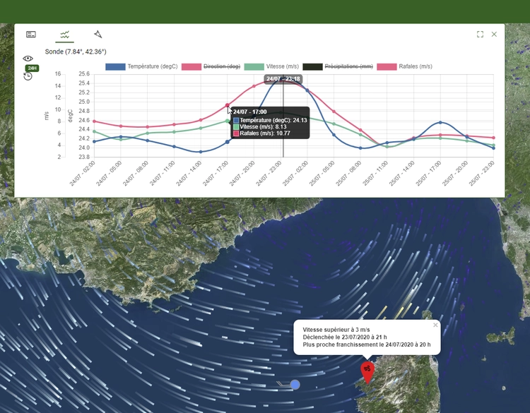
Our map data is also growing:
– high-resolution satellite images and orthophotos over France (up to 20cm in certain areas) for precise localization,
– environmental data from different measurement networks and weather forecast models for risk management.
Finally, you will discover in this version a first preview of the new features that will be improved by integrating your feedback in the coming months:
– the mainjournal allowing complete traceability of your events and the production of statistics,
– the catalog allowing you to integrate your business cartographic data into the maps,
– alerts allowing you to be automatically notified when environmental risks are detected.
Please note that from today the web address to access the application becomes https://aktnmap.kalisio.com, please update your bookmarks. For mobile applications, simply follow the update procedure.