📣 The summer period is often a good time to improve our tools, and the latest risk news sometimes brings us subjects of interest.
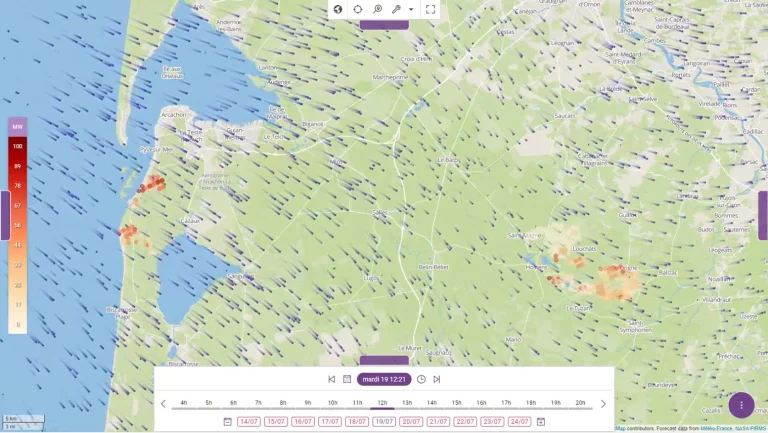
We have also recently developed a new method of processing open-source process using our ETL. Krawler for ingesting free data from the Fire Information for Resource Management System (FIRMS) from NASA. This system, particularly useful for fighting forest fires, uses satellite sensors to detect “hot spots” on the earth's surface. Using algorithms, it also provides various indicators linked to each hotspot, including Fire Radiative Power (FRP), which estimates the thermal power released.
The video below illustrates the spatio-temporal coupling of hotspots detected by FIRMS and current weather forecasts from Météo France (ARPEGE) at Kano. It provides a better understanding of the evolution of two major fires still in progress in Gironde, in particular the correlation between wind direction and intensity and those of the fires (the color of the representation of hot spots is linked to the FRP).