Meet us at the "Salon des Maires et des Collectivités" in Toulouse on October 8 and 9, 2021
Posted on July 13, 2023Sep 27, 2021
From October 8 to 9, we will be present at "Salon des Maires et des Collectivités" (the Mayors and Communities Meeting) in Toulouse, Diagora Labège, stand 73, to present our Akt'n'Map solution. Program supported by the Economic Development Agency of the Occitanie Region ( AD'OCC), Akt'n'Map is a digital solution to help you effectively manage risky situations... … Rencontrez nous au Salon des Maires et des Collectivités à Toulouse le 8 et 9 octobre
Meet us at the "Salon des Maires et des Collectivités" in Toulouse on October 8 and 9, 2021
From October 8 to 9, we will be present at the Mayors and Communities Show in Toulouse, Diagora Labège, stand 73, to present our solution to you Akt'n'Map. Program supported by the Economic Development Agency of the Occitanie Region (AD'OCC), Akt'n'Map is a digital solution to help you effectively manage risky situations. Come discover the solution and we will take the opportunity to call you back the possibilities we offer you to collaborate together.
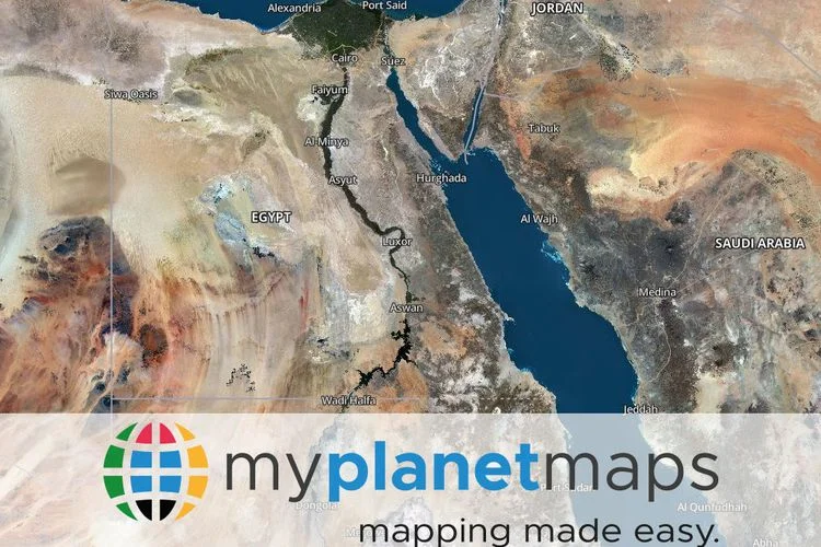
An optimized user experience thanks to My Planet Maps, a new online mapping service
CLERMONT-FERRAND, France – September 21, 2021 – PlanetObserver and Kalisio today unveiled My Planet Maps: a new subscription-based online map service that provides immediate access to recent, global data. The platform encompasses high-performance vector and raster maps. By accessing data through this highly reliable web map service, users save the costs of handling, storing, and updating their data in-house.
Optimize your GIS projects with reliable and efficient data
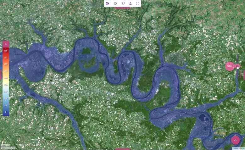
My Planet Maps offers fast and easy streaming access to high-quality global map content, updated regularly. The maps offered include a global mosaic of 10-meter resolution satellite imagery, 50 cm and 20 cm resolution orthophotos of France, and OpenStreetMap maps available in different styles.
The global imagery mosaic, produced by PlanetObserver, is at the heart of the My Planet Maps experience. Thanks to advanced colorimetric processing processes, this layer offers a unique and homogeneous visual experience up to a resolution of 10 meters. It provides a rich and reliable geographic context updated annually. In addition, a layer of high-resolution orthophotographs of the whole of France completes it, recently released by the IGN (National Geographic Institute) which provides extremely detailed geographic information.
In addition, a set of global vector maps of different styles completes the platform to offer a complete user experience. In addition, a hybrid layer combining imagery and vector data provides a detailed reference map covering the entire world. All layers are perfect for tracking and communicating on various activities anywhere on the globe.
Efficient online mapping service that is easy to integrate into GIS workflows
My Planet Maps users can easily connect their GIS applications (ArcGIS, QGIS, etc.) and business applications to the platform. Imagery and vector data are accessible via OGC-standard web services (WMS, WMTS, TMS). This greatly simplifies the access and integration of high-quality data. In addition, Airbus and IRSN (French Institute for Radiological Protection and Nuclear Safety) are already using the platform, developed by Kalisio. Users are fully satisfied with their daily access to the service and appreciate its reliability.
With the My Planet Maps online mapping service, users can easily combine global imagery and vector maps available on the platform with their own content and work environments.
My Planet Maps provides solutions to many projects based on geospatial data. Mapping projects, mission and operations planning, territory management, resource tracking and more, are fully adapted to this service. It supports users in their missions, whether in defense and intelligence, territory management and mapping, energy or civil engineering.
About PlanetObserver
Based in France and created in 1989, PlanetObserver specializes in the processing and production of geospatial data, satellite imagery and high added value 3D data. The company develops innovative products that maximize the visual and technological performance of its clients’ projects and solutions in the Defense, Aeronautics, Cartography and GIS sectors. Thanks to a constant commitment to R&D and innovation, PlanetObserver positions itself as the supplier and partner of leading companies located in Europe, North America and Asia-Pacific.
About Kalisio
Kalisio is a company that uses geospatial technologies to offer innovative solutions for real-time environmental control. The main use cases are crisis prevention and management or monitoring of interventions in the field. The company has a complete range of solutions for processing, ingesting, distributing and exploiting geospatial data.
Kalisio is also a player in the free world: we contribute, sponsor and develop Open Source solutions. These solutions also make it possible to promote open data from administrations (Open Data). At Kalisio, we implement a collaborative development policy with our partners. In a spirit of open innovation, we participate in the digitalization of territories and fight against the digital divide.
Kalisio signs an agreement with SMMAR
Posted on July 13, 2023Aug 30, 2021
As part of its Innovation Contract with the Occitanie region's economic development agency (AD'OCC), Kalisio has signed an agreement with SMMAR. One of the objectives of this ambitious R&D program is to evaluate the possibility of creating predictive water level models based on artificial intelligence, in order to better prevent the risk of flooding. … Kalisio signe une convention avec le SMMAR
As part of its Innovation Contract with the Occitanie regional economic development agency (AD’OCC), Kalisio signe une convention avec le SMMAR. Indeed, one of the objectives of this ambitious R&D program is to evaluate the possibility of creating predictive water level models based on artificial intelligence, in order to better prevent the risk of flooding. Thanks to this agreement, Kalisio will be able to exploit the hydrometric measurements of SMMAR, which owns a number of measuring stations within its perimeter, in addition to the stations already accessible via the portal Hub’Eau.
By synchronizing forecasts with real-time visualization of the extent of a zone below a certain level (look video) we could know precisely, and several hours in advance, the potentially flooded areas of a region.
To provide the best experiences, we use technologies such as cookies to store and/or access device information. Consenting to these technologies will allow us to process data such as browsing behavior or unique IDs on this site. Failure to consent or withdrawal of consent may adversely affect certain features and functions.
Functional
Always active
Technical access or storage is strictly necessary for the legitimate purpose of enabling the use of a specific service explicitly requested by the subscriber or user, or for the sole purpose of transmitting a communication over an electronic communications network.
Préférences
L’accès ou le stockage technique est nécessaire dans la finalité d’intérêt légitime de stocker des préférences qui ne sont pas demandées par l’abonné ou l’internaute.
Statistiques
Le stockage ou l’accès technique qui est utilisé exclusivement à des fins statistiques.Le stockage ou l’accès technique qui est utilisé exclusivement dans des finalités statistiques anonymes. En l’absence d’une assignation à comparaître, d’une conformité volontaire de la part de votre fournisseur d’accès à internet ou d’enregistrements supplémentaires provenant d’une tierce partie, les informations stockées ou extraites à cette seule fin ne peuvent généralement pas être utilisées pour vous identifier.
Marketing
Technical access or storage is necessary to create user profiles in order to send advertisements, or to track the user on a website or on several websites with similar marketing purposes.