First of all, our online help is getting a makeover! On the one hand, it is now accessible via a new presentation site. On the other hand, each feature of the application includes an interactive tutorial to guide you step by step when you are lost... … Une nouvelle version majeure d’Akt’n’Map est disponible
First of all, our online help is getting a makeover! On the one hand, it is now accessible via a new presentation site. On the other hand, each feature of the application includes an interactive tutorial to guide you step by step when you are lost (to do this, click on the ? icon in the top bar at any time).
Then, many ergonomic improvements are on the program:
– quick and direct photo capture from your events,
– free zoom on the photos of your events,
– interactive magnifying glass on the text content of your events,
– list and modify labels by batch to simplify their management.
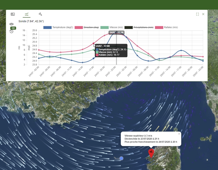
– high-resolution satellite images and orthophotos over France (up to 20cm in certain areas) for precise localization,
– environmental data from different measurement networks and weather forecast models for risk management.
Finally, you will discover in this version a first preview of the new features that will be improved by integrating your feedback in the coming months:
– the mainjournal allowing complete traceability of your events and the production of statistics,
– the catalog allowing you to integrate your business cartographic data into the maps,
– alerts allowing you to be automatically notified when environmental risks are detected.
Please note that from today the web address to access the application becomes https://aktnmap.kalisio.com, please update your bookmarks. For mobile applications, simply follow the update procedure.
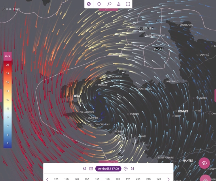
Tracking Storm Alex with Kano!
Posted on July 13, 2023Oct 2, 2020
Tracking storm Alex on October 2nd to assess areas at risk based on different weather elements (wind, rain) with Kano> Watch the video.
Tracking storm Alex on October 2nd to assess areas at risk based on different weather elements (wind, rain) with Kano> Watch the video.
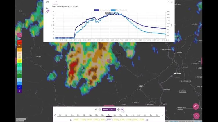
Visualization of floods in the Gard!
Posted on July 13, 2023Sep 21, 2020
Watch the replay of the situation in Anduze this Saturday, September 19. The video illustrates the correlation between data from the Hub’Eau hydrographic network, the Vigicrues network and the Radar observations> Watch the video.
Watch the replay of the situation in Anduze this Saturday, September 19. The video illustrates the correlation between data from the Hub’Eau hydrographic network, the Vigicrues network and the Radar observations> Watch the video.
To provide the best experiences, we use technologies such as cookies to store and/or access device information. Consenting to these technologies will allow us to process data such as browsing behavior or unique IDs on this site. Failure to consent or withdrawal of consent may adversely affect certain features and functions.
Functional
Always active
Technical access or storage is strictly necessary for the legitimate purpose of enabling the use of a specific service explicitly requested by the subscriber or user, or for the sole purpose of transmitting a communication over an electronic communications network.
Préférences
L’accès ou le stockage technique est nécessaire dans la finalité d’intérêt légitime de stocker des préférences qui ne sont pas demandées par l’abonné ou l’internaute.
Statistiques
Le stockage ou l’accès technique qui est utilisé exclusivement à des fins statistiques.Le stockage ou l’accès technique qui est utilisé exclusivement dans des finalités statistiques anonymes. En l’absence d’une assignation à comparaître, d’une conformité volontaire de la part de votre fournisseur d’accès à internet ou d’enregistrements supplémentaires provenant d’une tierce partie, les informations stockées ou extraites à cette seule fin ne peuvent généralement pas être utilisées pour vous identifier.
Marketing
Technical access or storage is necessary to create user profiles in order to send advertisements, or to track the user on a website or on several websites with similar marketing purposes.